Was this helpful?
Example: City Laneway Tour
Using the Alpaca services, it is quick and easy for your content team to plot walking trails, bike paths, and other routes on a map. This example shows how you can create a custom presentation of a city walking tour.
The above example shows loading an Alpaca itinerary on to a map. The itinerary editor was used to make it easy to plot the routes, which require a tool for dropping specific points and choosing specific routes along the way.
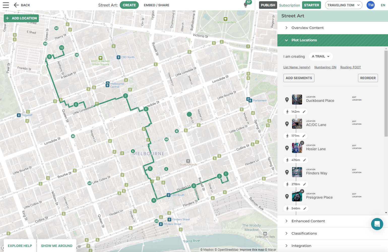
 Content teams can use the Alpaca Itinerary Editor in order to plot-out the
paths of content exactly how they want, with images, text and can link
to place information.
Content teams can use the Alpaca Itinerary Editor in order to plot-out the
paths of content exactly how they want, with images, text and can link
to place information.
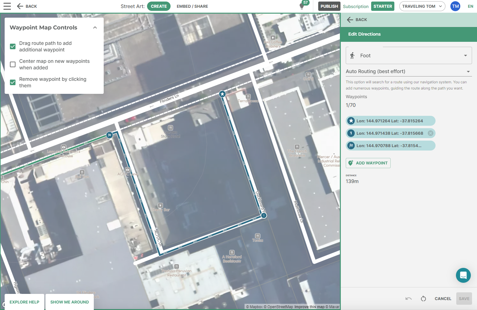 Routing can be controlled to be as specific as you want, with the ability to
choose the exact path you want to take. It isn't about trying to go the
fastest way, it's about choosing exactly the path to take for the experience.
Routing can be controlled to be as specific as you want, with the ability to
choose the exact path you want to take. It isn't about trying to go the
fastest way, it's about choosing exactly the path to take for the experience.
alpaca.tech
Copyright © 2026 - Made with love ❤️ in Australia.