Was this helpful?
Viewing Your Itinerary in QGIS
QGIS is a free and open-source geographic information system (GIS) software that allows users to visualize, edit, and analyze geospatial data. If you have created an itinerary on the Alpaca Travel platform, you can easily view your itinerary data in QGIS by adding a Vector Tile Connection.
Reference:
- Working with GeoJSON and Vector Tiles An overview to getting started with GeoJSON and Vector Tiles when working with itineraries.
- Alpaca Travel GeoJSON and Vector Tiles Reference
Adding a Vector Tile Connection
To add a Vector Tile Connection in QGIS, follow these steps:
Open QGIS and go to the Browser panel on the left side of the screen.
Right-click on the Vector Tiles folder and select New Connection.
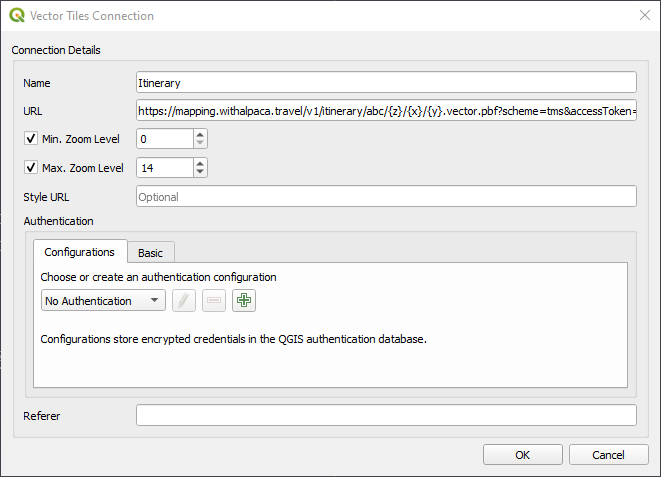
In the Vector Tiles Connection dialogue box, enter a name for your connection (e.g., Alpaca Travel Itinerary). In the URL field, enter the x,y,z URL provided by Alpaca Travel:
https://mapping.withalpaca.travel/v1/itinerary/abc/{z}/{x}/{y}.vector.pbf?scheme=tms&accessToken=YOUR_ACCESS_TOKENReplace "itinerary/abc" in the URL with your own itinerary ID, and replace "YOUR_ACCESS_TOKEN" with your access token.Click OK to save your new connection.
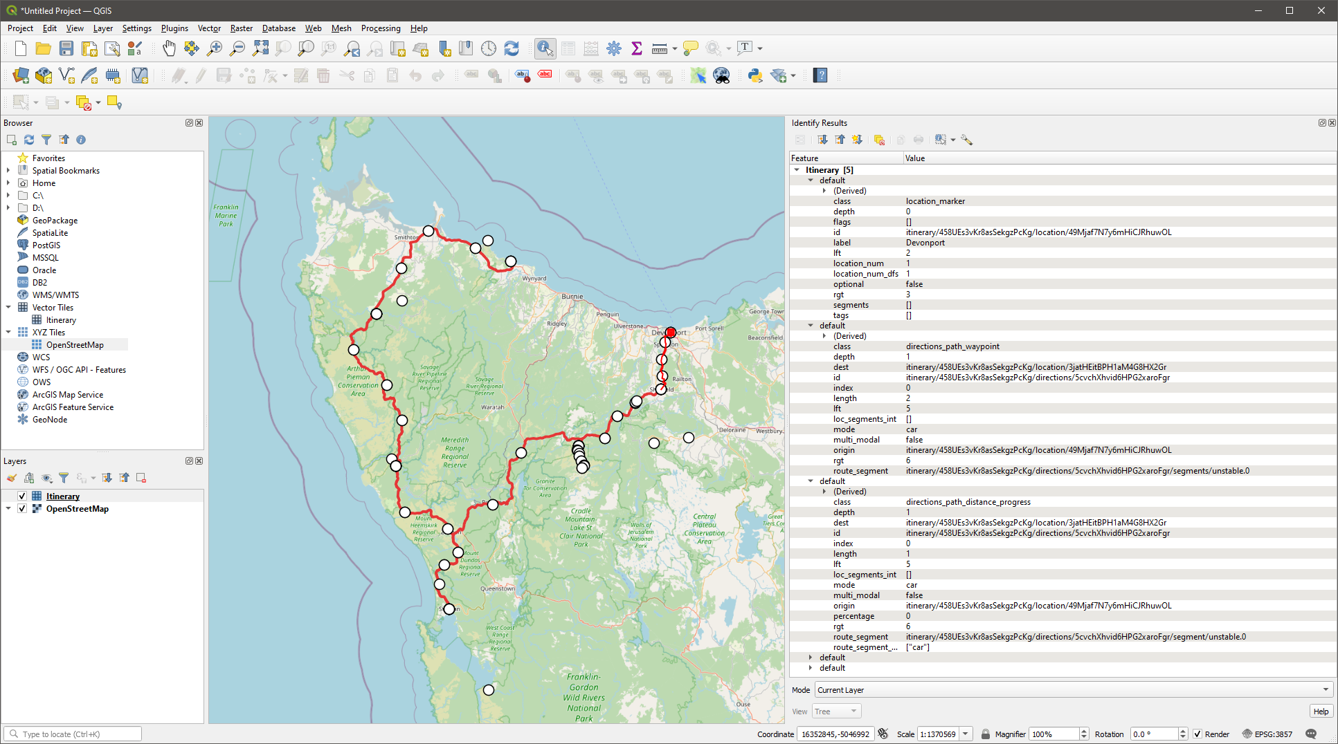
Your Alpaca Travel itinerary will now be available under the Vector Tiles folder in the Browser panel. Simply drag and drop it into the QGIS canvas to view your itinerary data on the map.
alpaca.tech
Copyright © 2026 - Made with love ❤️ in Australia.